Hollinwood Canal – Route
See also … Maps Virtual Cruise Features History The Hollinwood Canal is derelict and navigation is no longer possible. It ran to the east of Manchester, heading generally northwards from the Ashton Canal at Fairfield...
by Paul · Published 29/03/16
See also … Maps Virtual Cruise Features History The Hollinwood Canal is derelict and navigation is no longer possible. It ran to the east of Manchester, heading generally northwards from the Ashton Canal at Fairfield...
by Paul · Published 29/03/16 · Last modified 01/05/22
The Manchester & Ashton Under Lyne Canal, now know simply as the Ashton Canal, ran east from Manchester to Ashton Under Lyne. The Stockport Branch Canal linked the canal to Stockport. The Hollinwood Branch...
by Paul · Published 28/03/16 · Last modified 29/03/16
Distances are measured from Fairfield Junction with the Ashton Canal. Kilometerage Feature 00.000 Fairfield Junction with the Ashton Canal. 00.230 Manchester Road Bridge. 00.590 Harrison’s Bridge. 00.955 Medlock Street Bridge. 01.255 Swing Bridge. Gone. 01.730...
by Paul · Published 28/03/16 · Last modified 16/07/20
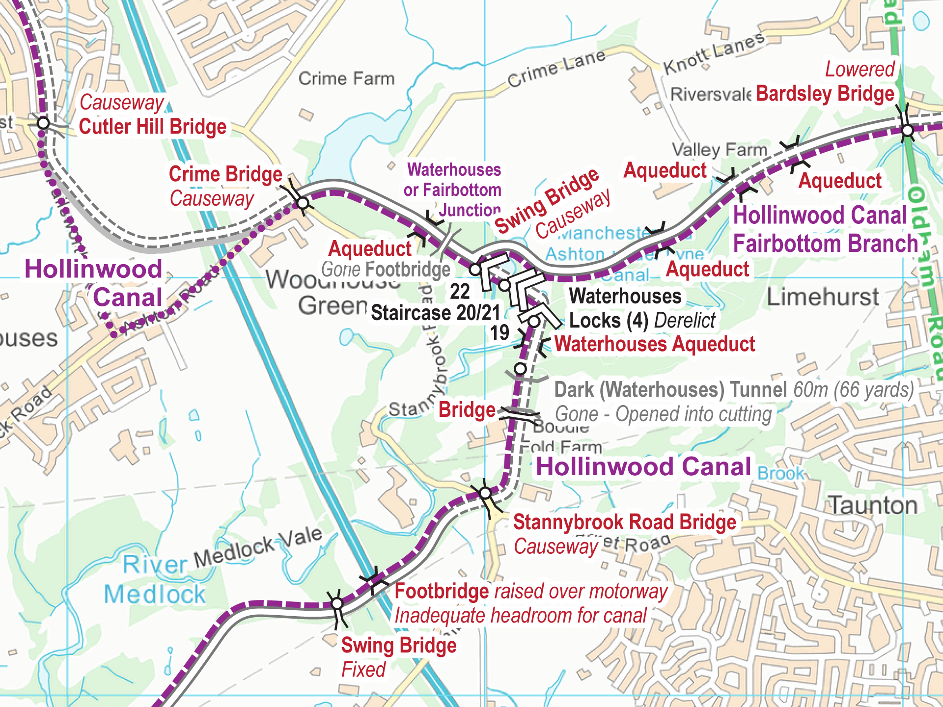
Maps of the Hollinwood Canal are available for download – FREE. The maps cover the Hollinwood Canal, including the Fairbottom Branch, plus the Werneth Branch Canal and the Stockport Canal, all in one map....
by Paul · Published 28/03/16
Distances are measured along the Hollinwood Canal from Fairfield Junction with the Ashton Canal. Kilometerage Feature 04.200 Waterhouses (Fairbottom) Junction with the Hollinwood Canal. 04.685 Aqueduct. 04.905 Aqueduct. 05.065 Aqueduct. 05.345 Bardsley Bridge. Bridge...
by Paul · Published 26/12/18 · Last modified 23/12/22
Free Maps These are my free maps covering the Hollinwood and Stockport Canals. Download these free maps (from the links at the end) to see how good my maps are, and to check you...


Recent Comments